
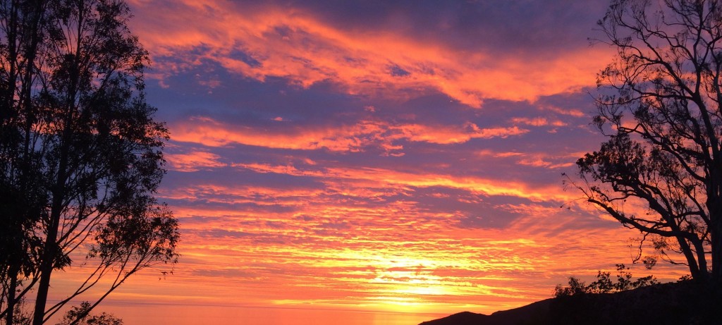
When the rains sweep clean the L.A. Basin, hiking is in order. Here are three worthy places to explore.
Admit it – you’re perfectly happy not to be living back East with all those dreadful snowstorms. For many, the single next best reason to live in LA (besides the weather) is the extensive trails that weave through the local mountains. If you doubt us, take a look right here for inspiration. To celebrate our good fortune, we took a few happy hikes into the canyons. Here are our three faves.
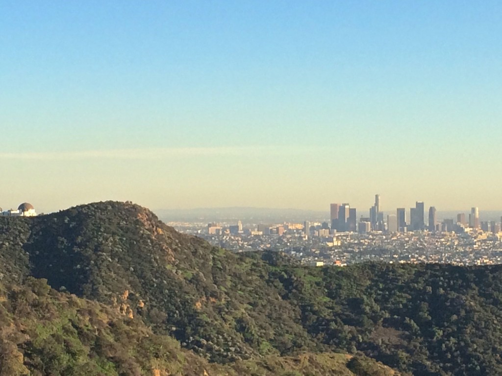
THE NIKE STATION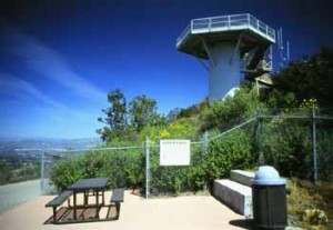
Photo credit: Karin Mueller
We’ll start with the Nike missile station, which provides a great opportunity to see something that might be new to you, even though it’s old. Although the station itself isn’t a jaw dropping sight, its definitely a cool place to explore and offers views of the city and valley sides of the San Vicente Mountains. This landmark is located along the popular Mountaingate hiking trail, and can also be reached by heading to the top of the Westridge trail off Mandeville Canyon.
As a remnant of the Cold War, Nike stations have been largely forgotten. Several still exist in the United States, as well as Germany and Italy, but they don’t make headlines all that often. Nike missile stations were used during the 50s to protect the cities they inhabited from soviet missile attacks. They used technology that could detect and intercept missiles midair, but this tactic was quickly taken over by long-range technology, leading to a lessening of the stations’ importance.
DIRECTIONS: Get there by exiting the 405 at Skirball and go left on Mullholland, and keep driving until you reach Encino Hills Drive. If you want to get extra walking in and/or don’t like the idea of driving your car on rather rough roads, go ahead and park here. Walk or drive up Encino Hills Drive to the left. Ahead you’ll see more parking, as well as one end of the Mountaingate trail straight. To get to the station, veer to the right up the path. You should arrive in about 20 minutes; just go left when you see a sign that reads LA96C in big bold letters and have fun exploring!
You can also access the Nike Station by driving to the top of Westride, off Mandeville Canyon Road, park at the fire trail and walk up and up and up. You’ll eventually see the station at the top of the mountain. The hike takes at least an hour to get up (and just as long to descend). For more information and directions, visit LAMountains.com or hikespeak.com.
LOS LIONES
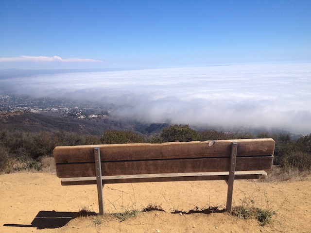
The Paseo Miramar trail in the Palisades has a vast set of options that could keep a seasoned hiked up from dawn ’til dusk. Fortunately there are many ways to break this beast of a trek down into more do-able chunks. The views are always spectacular, a great way to see the city without actually being immersed in it. The rugged unevenness of the path takes you even further out of daily civilized life and brings a new appreciation to taking it all in. We encourage you to explore all that the trail has to offer, but only to the best of your confidence and ability. Especially when it’s hot out, lots of water and sunscreen are a must. Be sure to watch out for mountain bikers coasting down hill, but don’t let that distract you from these wonderful views. Again, check out hikespeak.com for more details on this trail.
DIRECTIONS: We began by driving up Paseo Miramar until it dead ends into the trailhead. Find parking anywhere along the street and start walking up the fire road. It’s not far until the Los Liones trail comes in, which will take you to the Parker Mesa Overlook about two and a half miles ahead. Stop here to catch your breath, let the burning in your calves die down, and look around. This was our final destination, but if you’re feeling good and ambitious, Trippet Ranch, Eagle Rock, and Dirt Mulholland all lie ahead.
BEACHWOOD CANYON / HOLLYWOOD SIGN
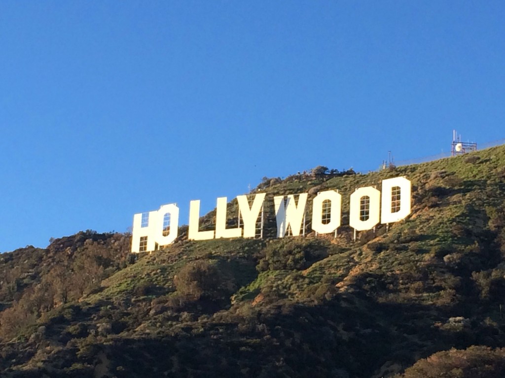
Finally, we explored a trail that leads to a terrific view of the Hollywood sign. Access to the sign via Beachwood Drive was relatively limited to those outside the neighborhood prior to the beginning of this year. In response to requests for better access to the trail for visitors as well as a sense of privacy (and available parking) for nearby homeowners, the city closed the canyon while constructing a gate that makes the trail easy to get to during the week but limits traffic on weekends. Now that its opened up, we decided to take the opportunity to see just how up close and personal we could get with a defining feature of Lala Land.
DIRECTIONS: We’ve found a great access point at Sunset Ranch: if you’re lucky enough to snag a spot in the very small, very rustic ranch “lot”, your hike essentially begins as soon as you exit your car. Otherwise, you’ll have to try your luck farther down Beachwood, but know that peeking around houses at the top of the street doesn’t really do the sign justice. Beachwood Drive runs perpendicular to Franklin Avenue, just keep heading up and up past the Beachwood market, cafe, flower shop, etc. until you can go no further. Once you’ve arrived at the ranch parking (you’ll see a sign on the gate), walk up the narrow path on the right side of the street, sort of in front of the parking area.
You’ll be instantly greeted with sweeping landscape views and a peek at the sign behind you, but it only gets better. Walk around to the left and follow the trail uphill. There are more spots to see the sign from up here, but keep climbing! The incline will only have you breathing heavily for a short amount of time; it relaxes a bit after you pass the stables below you. Then there will be a longer stretch of mild incline, and soon you’ll reach another “level” of the trail where you can make a hard left and go up, or keep going straight. Make the left.
This is where the hike turns in to more of a walk–aaah. Enjoy taking in the scenery as you wind around the mountain. Eventually you’ll arrive about as close to the Hollywood sign as we imagine you can get! It’s certainly family friendly, dog friendly, and camera friendly. We suggest going later in the afternoon, when the sun isn’t quite as strong and the light is a nice soft orange. This route takes roughly an hour, depending on if you power walk the whole thing or stop for photo shoots.
